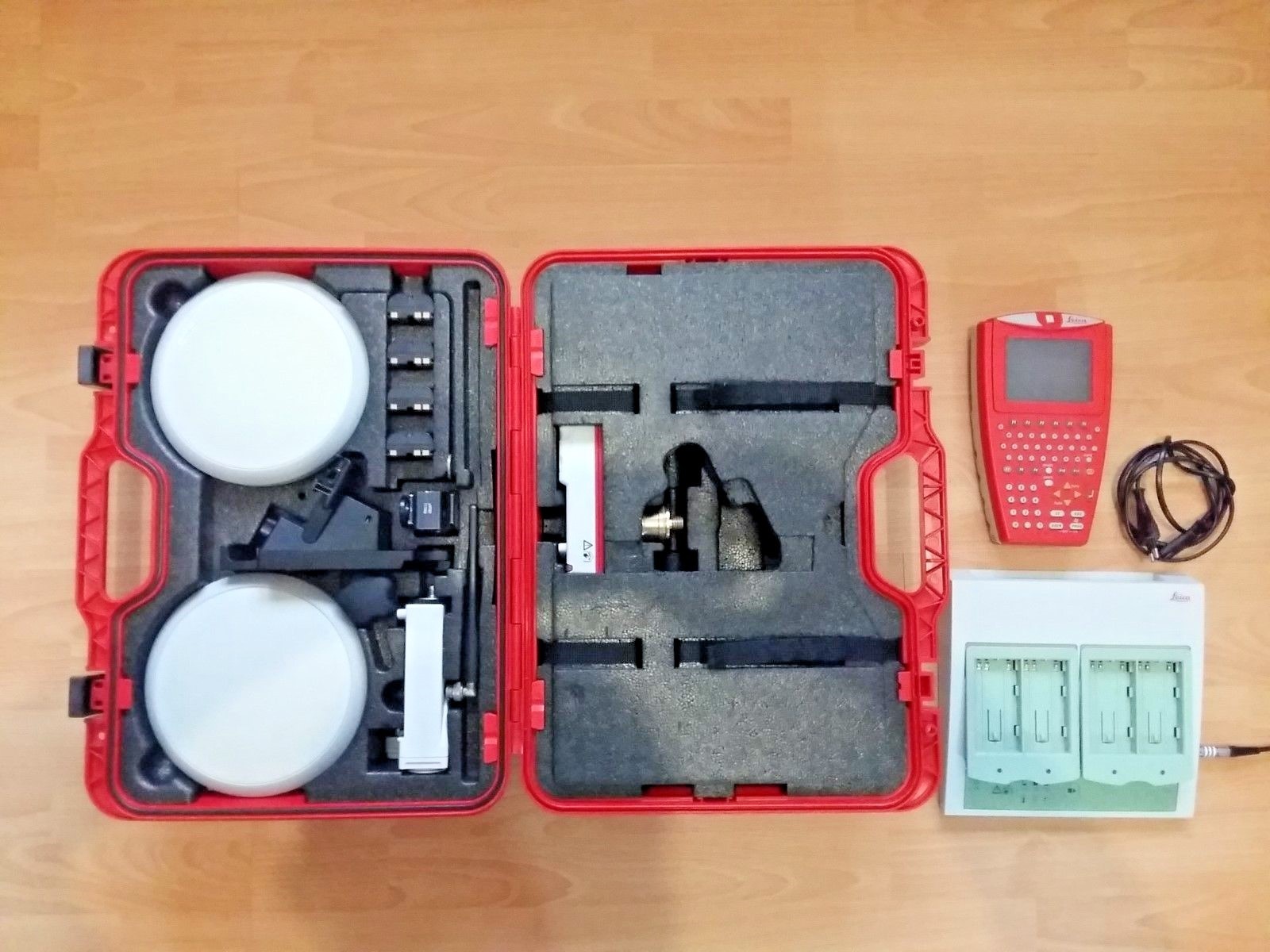
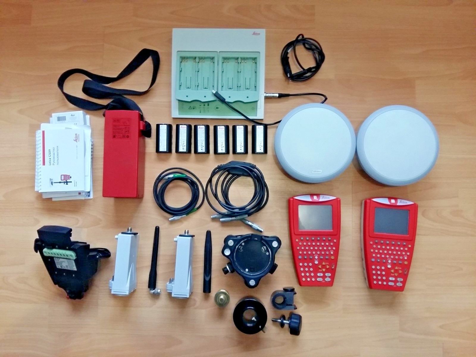
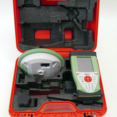
LEICA GS09 GNSS
Your tasks, your choices, our solutions!
Are you starting a new business? Have you been considering changing to GNSS surveying? Then the Leica GS09 is the surveying system for you. Providing a simple positioning tool that grows with your business to meet all your future measurement requirements.
The Leica GS09 can be used in a large variety of operating modes, providing you with a complete surveying system. Requiring only the GS09 SmartAntenna and CS09 Controller, combined with appropriate accessories, many different operating choices are available.
SmartWorx Controller
The SmartWorx field software is based on the proven and familiar concept of the Leica System 1200. Made even easier to use with icon-based menus, ensures instant productivity.
RTK Rover
The extremely light-weight and cable free rover is comfortable to use for the entire day. Built exceptionally rugged, the rover withstands rough use and topple overs.
Reference Station
The easily setup RTK base station requires only the GS09 SmartAntenna, a radio modem and battery. By connecting the CS09 Controller, raw satellite data can be logged.
Network Rover
The Leica GS09 works perfectly in all reference networks. The network corrections can be received with Leica GSM/CDMA modules or by using your mobile phone.
SmartStation
Leica TPS instruments can be combined with the GS09 SmartAntenna into one easy-to-use instrument
| GNSS Technology | Measurement Engine | |
| Leica patented SmartTrack+ technology | · Jamming resistant measurements · High precision pulse aperture multipath correlator · Excellent low elevation tracking technology · Very low noise GNSS carrier phase measurements with <0.5 mm precision · /SPAN>Minimum acquisition time |
|
| No. of channels | 120 channels | |
| Reacquisition time | < 1sec | |
| GNSS Measurements | ||
| Satellite signals tracking | GPS: L1, L2, L2C (C/A, P, C Code) GLONASS: L1, L2 (C/A, P narrow Code) |
|
| Measurement Performance | Accuracy 1 | |
| DGPS/RTCM | Typically 25 cm (rms) | |
| RTK Rapid static (phase) Static mode after initialization |
Horizontal: 5 mm + 0.5mm (rms) Vertical: 10 mm + 0.5 ppm (rms) |
|
| RTK Kinematic (phase) Moving mode after initialization |
Horizontal: 3 mm + 0.5 ppm (rms) Vertical: 6 mm + 0.5 ppm (rms) |
|
| Post Processing (phase) Static with long observations |
Horizontal: 5 mm + 0.5 ppm (rms) Vertical: 10 mm + 0.5 ppm (rms) |
|
| One-The-Fly initialization | ||
| Reliability | Better than 99.99% using Leica SmartCheck+ Technology | |
| Time for initialization | Typically 8 sec 2 | |
| RTK baseline range | Up to 50 km | |
| User Interface | ||
| Keys | On / Off key | |
| Led Status indicator | Satellite tracking, Bluetooth® communication and battery power | |
| Communication ports | · Combined USB / Power port with 8-pin Lemo plug · Integrated Bluetooth® port · 5-pin clip on contacts for Leica SmartStation setup |
|
| Physical | ||
| Weight | 1.05 kg including battery | |
| Dimension (diameter x height) | 186 mm x 89 mm | |
| Environmental specifications | ||
| Temperature, operating | -40ºC to +65 ºC (-40 ºF to +149 ºF) 3 | |
| Temperature, storage | -40 ºC to + 80 ºC (-40 ºF to +176 ºF) 3 | |
| Humidity | 100% 4 | |
| Sealed against water | IP67: Temporary submersion into water (max. dept 1m) | |
| Sealed against sand and dust | Dust tight, protection against blowing dust | |
| Vibration | Withstands vibrations in compliance with ISO9022-36-08 | |
| Drops | Withstands 1m drop onto hard surface | |
| Topple over | Withstands topple over from a 2 m survey pole onto hard surface | |
| Functional shock | No loss of lock to satellite signals when used on a pole setup and submitted to pole bumps up to 150 mm | |
| Power management | ||
| Supply Voltage | Nominal 12V DC, Range 10.5 – 28V DC | |
| Power consumption | Typically: 1.8W, 150 mA | |
| Internal Power time | Up to 7 hours using GEB212 battery5 | |
| Communications | RTK transmission | |
| Source | Direct from GS09 (No datalogger required) | |
| RTK format | Leica Life propriety format | |
| Radio Modems | All Satellite and Pacific Crest radios in GFU or standard housing | |
| Integration with TPS | ||
| SmartStation functionality | Connects to Leica TPS1200, TS30 and TM30 instruments | |
Leica CS09 Controller
| User Interface | Standard software | |
| Operating system | Microsoft Windows CE 5.0 software | |
| Application software | Leica SmartWorx field software | |
| Terminal software | Leica SmartWorx sensor control | |
| Software control | ||
| Display | ¼ VGA colour, graphics capable | |
| Touch screen | Toughened film on glass | |
| Keyboard | 62 keys with QWERTY alphanumeric function keys | |
| Illumination | Backlight illuminated display and fully illuminated keys | |
| Hardware | Physical | |
| Dimension | 218 mm x 123 mm x 47 mm | |
| Weight of CS09 | 740g including battery | |
| Weight of pole setup | 3.47 kg for complete rover pole setup | |
| Weight of network rover | 2.85 kg for complete network rover using a Bluetooth® mobile phone | |
| Interfaces | ||
| Data storage | Removable CF card (256 MB and 1 GB available) | |
| Communication ports | · Combined USB/Power port with 8-pin Lemo plug) · 2 x Bluetooth® ports Class 2 · 7-pin clip on contacts for GHT56 SmartHolder connection |
|
| Environmental Specifications | ||
| Temperature, operating | -30ºC to +65 ºC (-22 ºF to +149 ºF)3 | |
| Temperature, storage | -40 ºC to +80 ºC (-40 ºF to +176 ºF)3 | |
| Humidity | 100%4 | |
| Sealed against water | IP67: Temporary submersion into water (max. depth 1 m) | |
| Sealed against sand and dust | Dust tight, protection against blowing dust | |
| Drops | Withstands 1.5 m drop onto hard surface | |
| Vibration | Withstands vibrations in compliance with ISO9022-36-08 | |
| Power Management | ||
| Supply Voltage | Nominal 12V DC, Range 11.5 – 28V DC | |
| Power consumption | Typically: 1.4W, 120mA | |
| Internal Power supply | Removable rechargeable Li-lon battery, GEB211 2.2Ah / 7.4V or GEB212 2.6 Ah / 7.4 V |
|
| Operation time | Up to 13 hours using GEB212 battery5 | |
| RTK specifications | ||
| Data Formats | Leica propriety formats (Leica, Leica Lite, Leica 4G) Optional CMR, CMR+, RTCM 2.1, RTCM 2.3, RTCM 3.0, RTCM 3.1) | |
| RTK baseline | Optional 5 km maximum baseline or unlimited baseline lengths | |
| Position update rate | 1 Hz standard, Optional 5 Hz (0.2 sec) | |
| Network Rover | VRS, FKP, iMAX, MAX, Nearest station | |
| External Devices | ||
| Radio Modem | Satellite and Pacific Crest radios in GFU housing (connected using GHT56 SmartHolder) |
|
| Mobile Phone | · GSM / CDMA modules in GFU housing (connected using GHT56 SmartHolder) · Bluetooth ® Mobile phones |
|
| GS09 SmartAntenna | · Bluetooth ® · USB Cable |
|
| PC with Microsoft Windows | · USN data cable · CF-card reader |
|
| Internet | Mobile phone using FTP protocol | |


There are no reviews yet.